The crown jewel of the Warren County Parks, Basil Griffin features a host of features and amenities unrivaled in Warren County.
Basil Griffin Park
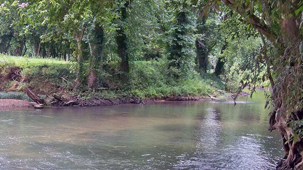
Phil Moore Park
Phil Moore Park has a wide range of facilities for sports, creek access, picnics, and even a soapbox track.
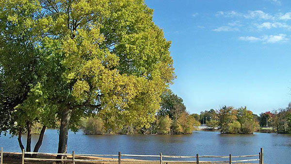
Romanza Johnson Park
Romanza Johnson Park features creek access, as well as a picnic shelter for the perfect place to grill out.
It’s been a while since we’ve seen Red Flag 🚩conditions but it’s here. We have posted Red Flags and access points will be closed until we fall back into yellow conditions again.
Phil Moore Park and Romanza Johnson Park both close at dark and any vehicles left unattended are subject to being locked in the park until 8am the next day
To get River Flag Updates on Drakes Creek, visit the USGS National Water Info System.
For more information and a map of the Warren County Blueways go to https://www.wku.edu/blueways/
For more information, call the WCPRD office at 270.842.5302.
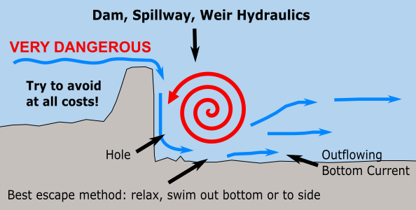
River Features
Hole/Hydraulics
- Located at Romanza Johnson Park
- Created when water pours over the ford in the river, creating a cavity and attempts to fill the cavity with the water traveling back upstream.
- VERY DANGEROUS – try to avoid!!
- If water flows over the ford DON’T try to boat over!
- Stay at least 10-15 feet away from the downstream side of the ford.
Strainers
- Obstacles in the water such as fallen trees (most common on rivers), rocks, midstream brush, collected debris between rocks and islands.
- Water flows through a strainer while boats and people may not.
- People or boats can be pinned or trapped!
- Avoid if possible.
Downstream V
- Forms between rocks with the tip pointing downstream.
- Points to the deeper parts of the rapids.
- This is where you want to be generally.
- When reading the river, downstream V means safe passage.
This system does not take the place of state river gauge readings, National Weather Service Warnings/Advisories, Special Weather Statements or other public safety agencies. The sole intention of this program is to help give both experienced and novice river recreational enthusiasts a better/visual/on-site cue of information about park ground, river access and river conditions.